

Singapore Planning Area
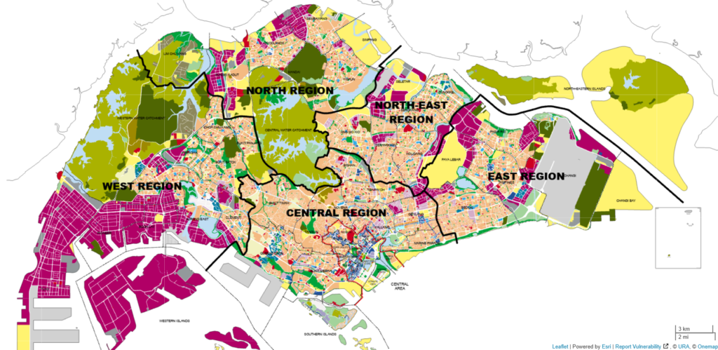
There are in general a total of 5 planning area in Singapore:
- Central Planning Region (CCR/RCR)
- East Planning Region (OCR)
- North East Planning Region (OCR)
- North Planning Region (OCR)
- West Planning Region (OCR)
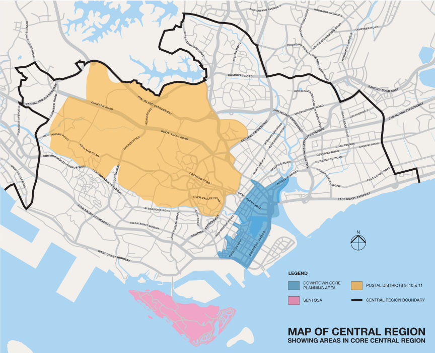
Among the Central Planning Region, only the following areas are considered CCR under URA’s map:
- District 9, 10, 11
- Downtown Core Planning Area (Mix of District 1, 2 and 6, 7 – Part)
- Sentosa (District 4 – Part)
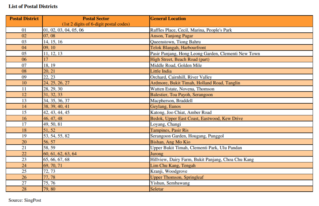
Singapore District Map Segmentation
There are a total of 28 Postal Districts in Singapore’s District Mapping system. It serves as a more granular layer beneath the CCR/RCR/OCR framework we’ve introduced in the previous post.
Key purposes of the District Map
For the Property Market
Districts help owners, investors compare transaction volume and price trends at a neighbourhood level — rather than just broad regions. Knowing that District 10 (Bukit Timah, Holland) commands different premiums than District 9 (Orchard) — even though both are CCR — gives far more useful pricing context.
For Neighbourhood Profiling
Districts also act as a shorthand for lifestyle and amenity profiles. District 15 (East Coast, Katong) signals a very different living experience from District 23 (Hillview, Bukit Panjang), even though both are OCR. The district label helps people quickly filter by the character of a neighbourhood.
For Investors
Rental yields, tenant profiles, and capital appreciation rates can vary significantly even within the same CCR/RCR/OCR band. Districts allow investors to drill down and identify micromarket opportunities.
In short, Planning Region gives you to macroscopic overview and CCR/RCR/OCR tells you the tier, while the District shares with you on the neighbourhood. They all work together — to give you better context on the Singapore Real Estate Market performance.